Pages

Showing posts with label Kluane. Show all posts

May 25, 2010

The Ballad of the Kluane Shiplap Spruce Boat


Riveted, shiplap on rib construction.  This is from an OLD boat.


In the days long ago, when the land was full of snow
A healthy old spruce tree was growin'
Reaching up high from the north summer light
Near a cool mountain stream ever-flowin'

A strong sense of place with its roots in embrace
Of the rocks and the sand and the soil
It could not foresee the great axe-swinging spree
Of a boat-builder ready for toil

If fell to the ground with a great thudding sound
Its needles and branches a-snappin'
Then dragged a few miles, cut, and thrown into piles
All the while asking "How could this happen?"

As the spruce lumber dried the great boat-builder cried:
"A fine little craft this will make here
For Kluane Lake has a tonne of fish to take
In the deep Yukon waters, cold and clear."

He measured and cut from the tip to the butt
Then he ran each new board through the planer
He fitted each slat and then riveted each flat
'Till he had him a floating container

So proud of his boat, he then set the thing afloat
And then rowed it across Lake Kluane
It had been too long since his last hooch and song
With his brother-in-law, Skookum Johnny

What he didn't know is the spruce refused to go
Any further from its place of growing
With a pop and a crack the boat split down its back
Then into the craft water was flowing

The boatman, I'm sure, never made it to shore
Kluane Lake water is chilling
The moral, you see, is to never cut a tree
Unless it is ready and willing


Washed high ashore.

May 23, 2010

Picture this...

I was in Dawson City last week. On the drive back I saw a sow bear and her two cubs. Wouldn't you know it, I didn't have a camera.

If I had had a camera, I would have taken pictures of the queerest sight I ever did see. Near Rock Island Lake along the North Klondike Highway, there was a row of spruce trees. That, in itself, is not strange at all - but out of the top of each spruce tree was a plume of something that had the consistency of smoke but the swirling and dancing motion of streams of northern lights. A closer look and I realized that the smoky, swirling streams coming out of the tops of the spruce trees were clouds of insects. I'm not sure what kind. I've never seen anything like it.

Man, I wish I'd had my camera.

Since I don't have any new pictures to post, I thought I'd post some more from my recent trip back from Beaver Creek. Actually, I'm doing it because my dad wanted to see more. My dad never says anything about my blog, so how could I not?

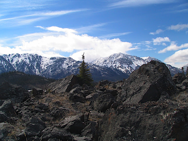
All of these pictures were taken in the Kluane Lake area.

Enjoying a feast of fresh, spring buds.

Yet another sheep on Sheep Mountain.


May 18, 2010

I just couldn't resist.


The drive around Kluane Lake near A'ay Chu (also known as Slims River) delta is stunning. And yet, until last week, I never took the time to stop and explore.

It all started with a brief investigation of a boat launch that turned into fun with candle ice; which then turned into a little bit of rockhounding; which then turned into a little hike up to the original Alaska Highway route to see Soldier's Summit, where the highway was officially opened on November 20, 1942.


There are lots of places to rest and lots of interpretive signage to read along the way.

View of Sheep Mountain from Soldier's Summit (which is on Sheep Mountain).

Plenty of sheep on Sheep Mountain, enjoying the afternoon sun.

A seam of something running through (and down) the mountain.

A'ay Chu/Slims River from the Old Alaska Highway.

Sheep Mountain Interpretive Centre. I've never been inside. It's closed every time I go by.

Along the trail, there were fantastic views of the A'ay Chu delta and what is normally an island in the bay (see the Google Earth picture above). From up on the original Alaska Highway, it appeared as if the island was no longer an island. The lake levels were so low that the island was now connected to the delta by a muddy plain.

Is it walkable? I asked myself.

The Island as seen from the Old Alaska Highway. Only 0.8 kms from the road, but what is the walking like?

It looks pretty wet. Should I bother?

To provide a little perspective, you can see the bridge across the river at the top of the photo. That's a lot of mud.

I just couldn't resist. There was only one way to find out if I could walk to the island and that was to try. From my raised vantage point I plotted the most likely route and skipped down the mountain to the muddy plain.

The mud was dry enough to start caking, but how solid could it be? I grew up in the prairies, where caking mud clumps to footwear like money clumps to Oprah.


I took my first tentative step. The mud was as hard as concrete.

It softened a little as I got further from the road, but when it did it felt more like I was walking on thick shag carpeting than on mud. I was expecting a thick layer of gunk to build up on my shoes, but it never did. The mud soon turned to hard sand and the walking was easy.

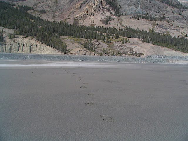
Footprints leading back to the car.

A stiff but not entirely unpleasant breeze was blowing down the valley, kicking up swirls of sand and creating pretty sand sculptures on the now-sandy delta.

A gust of wind and a blast of sand.


A little bit of swirling sand, partly caused by...

...road and bridge construction.

The island, warmed by the mid-afternoon sun, was lovely. There were trails around the island. I had heard, and I can't remember where, that someone wintered horses on the island. There was plenty of dried horse manure to support this story - but no horses.

First steps on the island.

Looking back across the sandy (it wasn't that muddy after all) plain. The car is an unidentifiable speck on the right-hand side of the picture.
Following the horse trails up the east side of the island, I watched the silty river create swirls of brown sediment in the clear blue-green lake.


I continued following the trails, which led me to a smooth, rocky outcrop on the top of the island. I had a fantastic 360o panorama from the island's peak. The best view, though, was looking back up the river valley.


Not finished with my exploring, I decided to circumnavigate the entire island. I started heading down the north side of the island which, unlike the south side, was thick with brush. The northern end of the island was surrounded by a sea of rotting ice.

Thick.

A sea of rotting ice, as seen from the island's peak.

Working my way back to the west side of the island, where there was less ice, I sat down and enjoyed the view of the water. The colour and clarity of the lake always impresses me. One might think I was hiking in more tropical climes.

But the ice proves otherwise.

Just another gorgeous view.

Having nearly circled the island, I found a nice little harbour, mostly sheltered from the rest of the lake. The wind on Kluane can churn up some spectacular waves so it's good to know where shelter can be found. As you can see by the shoreline, the water level is much lower than normal.

Cool, clear water. The muddy bottom makes it ideal for anchoring.

This little armada sure seems to like it there.


Although I was eager to get back to my family after a week away, I was reluctant to leave the island. Still, I was able to leave without any regrets. I hadn't planned on visiting the island but I just couldn't resist.

Do you think there are any support groups for people with compulsions to explore?

Explorers Anonymous, maybe? Ah, let's face it - for an explorer, twelve steps is never enough.

May 14, 2010

The Rockhound Instinct

I'm a rockhound. I come by it honestly: It's a trait I inherited from my dad. If I'm walking over, under, or beside any sort of rocky surface I cannot help by look closer. I think I'm genetically hardwired to do it. It's like a compulsion.

When I was nearing my high school graduation, I had no idea what I wanted to pursue as a career. I loved music, I loved geology, and I loved a lot of other subjects. My dad suggested that business was a good way to go - and he was right - but I still feel a strong pull toward geology. I have absolutely no interest in discovering the mother-lode or staking claims for a new mine; I just love understanding the geological history of the land and adore finding new and interesting rocks. I am by no means an expert in identification, though. I would like to, one day, change that. When I'm old and retired I might have to go back to university for exactly that reason: To learn how to identify the discoveries I come across.

When I made a stop at Kluane Lake, my brief investigation of a boat launch quickly turned into a rockhounding expedition. I couldn't resist. There were so many interesting rocks and minerals! Here are a few of the pictures I took from my hike. Maybe you can help me identify some of my finds.

There was lots of this stuff, whatever it is.


I'm not interested in the white mineral on the left. I'm more interested in the crystalline greenish-blue stuff on the right. What the heck is it?


Asbestos?


I didn't do any scratch tests or anything like that, but I think that's regular ol' quartz.


What is that reddish rock?


I think the green spots are chunks of oxidized copper. I'm not sure what else is in there.


Nothing particularly interesting about the rock. I just liked the spiral of lichen at the bottom.


Glacier scoured bedrock?


(I should note that I wasn't sure if the area I was on was part of Kluane National Park or not, so I left everything behind. It was all too big for me to take any anyway. You can rest assured that the pretty rocks are still there for others to enjoy. I kind of like it that way.)

May 13, 2010

The Candle-Ice Waltz

On my way back to Whitehorse from my week in Beaver Creek, I made a stop or two along the shores of Kluane Lake. 70 kilometers (43.5 miles) long and 400 km2 (154.4 sq. miles), it's the largest lake contained entirely within the Yukon border.

Looking forward to sailing on this great body of water, I wanted to investigate a boat ramp. I hopped out of my car and ran down the launch. To my disappointment, the water level is so low that nearly the entire ramp is exposed - not that I could use it anyway, given that the lake is still covered in ice.

Spring ice on Kluane Lake.


There wasn't much snowfall this year and I worried that there might not be enough snowpack in the mountains to raise the water level high enough to use the launch this season. I crossed my fingers and hoped I was wrong.

From the end of the ramp, I surveyed the lake. The sun was shining and the breeze refreshing. I couldn't resist a short walk down the shoreline.

As I walked and the breeze picked up, I heard a tinkling sound. Looking at the layer of rotting ice, just off the shore, I saw slivers of candle ice. They were clattering and ringing like wind chimes.

The wind died off and the chimes grew silent. I waited for more but the wind was taking an extended break. It wasn't long before I decided to lend a helping hand. I shot a few short video clips, which I have since put to music in a little segment I call "The Candle-Ice Waltz". You can watch here:


If, like me, you just can't get enough of candle ice, here are a few more photos from my visit.