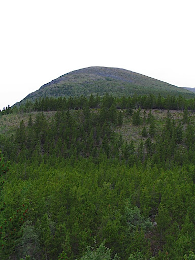
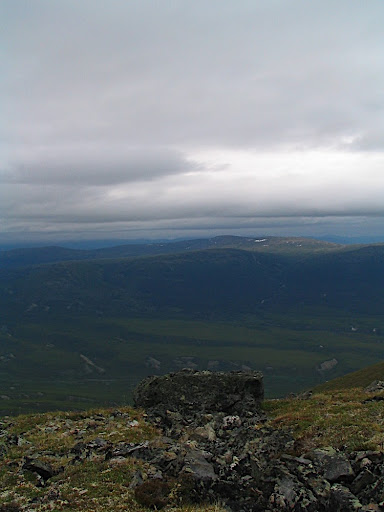
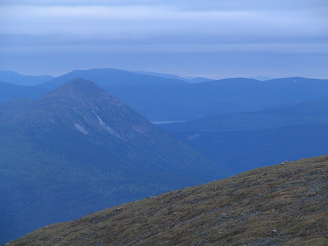
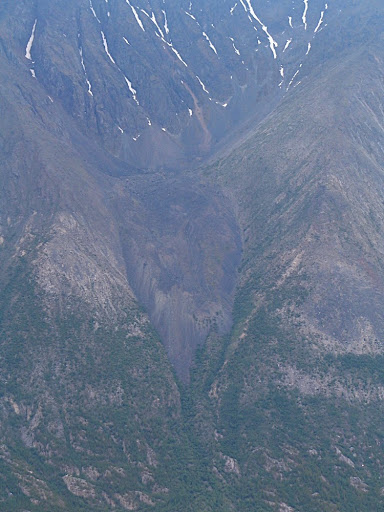
The Ibex Ridge (not to be confused with Ibex Mountain, further up the valley) is one of those mountains that, from the Alaska Highway, seems steep and threatening. When viewed from the East side, it seems friendly and approachable. From the south, in the Ibex Valley, it looms above, imposing and seemingly unattainable. Of course, appearances can be deceiving.
At the base of the mountain, near the Ibex River, are a series of large boulders, dropped from high above. This was the site of last weekend's Ibex Valley Bouldering Festival. The night before, Eric and I decided that we would drop in on the festival before attempting to summit the Ibex Ridge.
We parked along the Scout Lake road and unloaded our bikes for the ride into the valley. Nanuq was raring to go, running up and down the sandy road. Eric's dog, Luna, was a little more reserved and jogged alongside Eric. There were a lot of trucks and 4x4s on the road, heading into the festival site. I paced one right into the valley. I could have beat it if I'd been so inclined, but was satisfied enough with the "You're here already?" comment from one of the 4x4's occupants (I had been riding their bumper almost all the way in).
I set off to find my brother, Tim, who had driven in for the festival the night before. I found him sleeping in the back of his Pathfinder in a great little spot right beside the Ibex River. He seemed happy to see me, but more than a little exhausted. A few minutes later, I found out why. He'd had a near-death experience on the mountain. After being lured further and further up by the delectable wild raspberries and by the promise of some fantastic sunset pictures, he suddenly found himself stranded. It's a lot easier to climb up than it is to climb down and it had gotten dark. Expecting a short trip, he hadn't brought his usual gear. Using his camera flash as an SOS device, he signaled the festival-goers in the valley below. They attempted to communicate with him, but never figured out how dire his situation was and they never sent for help. After a cold, exhausting night, when there was enough light to see, he managed to make his way back down the mountain. His own account is much more interesting.
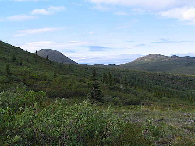
Eric and I didn't stay at the festival site for long. We biked back up the road, in search of a fire road offshoot that would take us as close as possible to our mountain approach. In the forties, the whole valley burned and the standing dead was used to keep homes in Whitehorse warm. The evidence of the burn is very apparent.
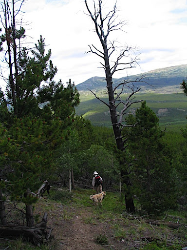
After a ride up one of the offshoots, we stashed our bikes and began the steep hike up through the cheery lodgepole pine and the dreary, charred deadfall. We reached the top of a ridge, only to find that it dropped steeply into a valley before leading up to another ridge. The ridges ran parallel to the mountain and walking up and down and up and down to get through the steep valleys is not a pleasant way to start a mountain ascent.
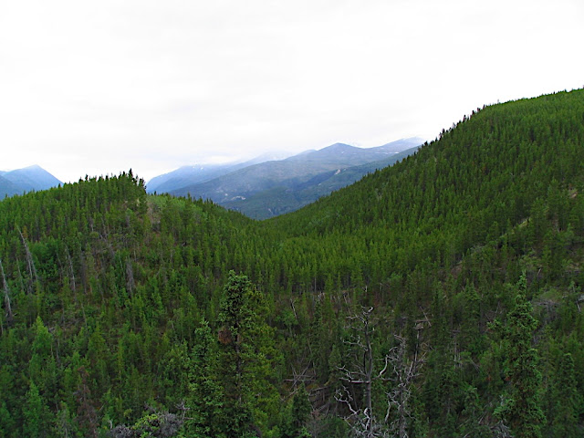
Ridges and valleys running perpendicular to the summit make an otherwise easy-looking approach into a frustrating one.
After a couple of ridge and valley disappointments, we decided to follow the ridge we were on until it ended. At the end, we saw another, steeper, valley that ran perpendicular to the ridge we were on. We spotted a game trail on the other side. From where we stood, it looked like the trail led further and further away from the summit before curving back to where we wanted to go. We decided that, in spite of its circuitous route, its gentle grade looked better than walking up and down and up and down on a more direct approach. Through many hard experiences, I have found that the most direct route is not always the best route.
Ridges and valleys mean up and down and up again.
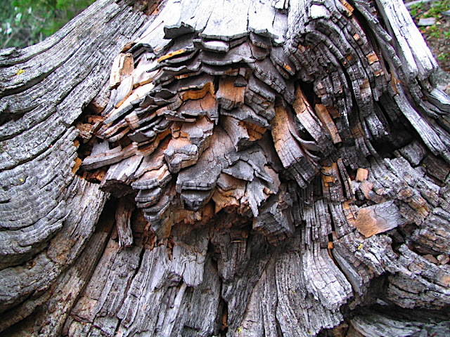
Tree rings.

The view from the clamber up to the game trail.
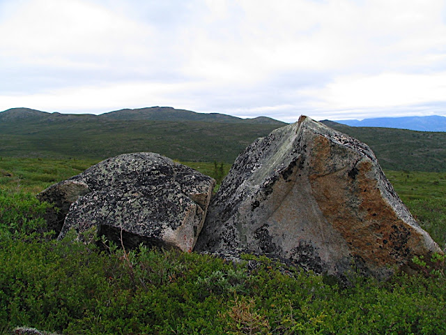
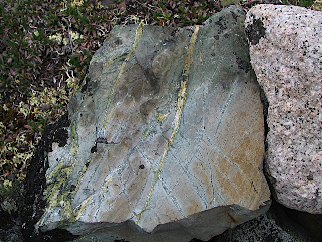
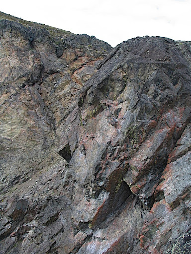
Mountains get too much attention. Sometimes it's nice to let the rocks that make the mountain get some of the limelight.
I had my reservations about attempting the summit. Clouds were moving in. A mountaintop can be a dangerous place when it's shrouded in fog. Eric was enthusiastic about continuing on, and I relented on the condition that, if the cloud situation did not improve - even if we were already close to the top - we would turn back. Naturally, we hoped it would clear up.

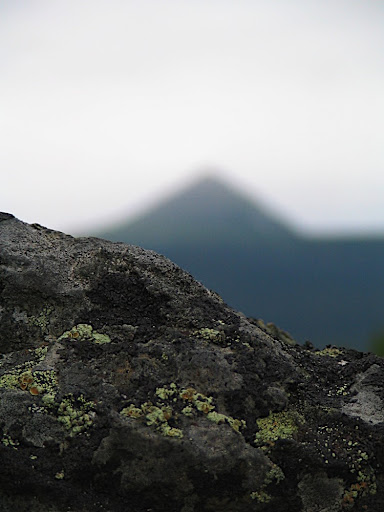
Clouds move in to obscure a far-off summit.

Clear sky! Will it last?
The walk up the game trail was comparatively easy. It was much better than walking up and down valleys and picking our way through old firekill. Old moose and caribou tracks demonstrated the route's popularity, as did a blaze that somebody had carved into a poplar tree.
There was a set of hoodoos along the way that looked like they had been made out of poor-quality concrete. Hoodoos may not serve any purpose (as far as I can tell), but they sure are neat.
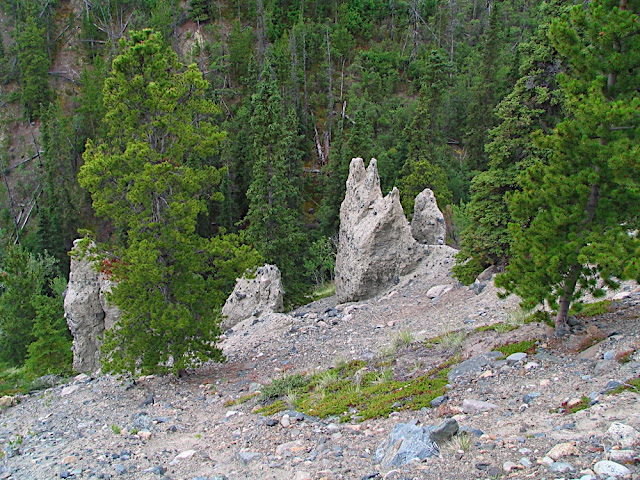
A group of hoodoos.

A big 'ol hoodoo. I threw a rock down there for Nanuq to chase. You can see him in the bottom left-hand corner of the picture if you want to get an idea of scale.
As I looked over on the other side of the ravine, I could see that we had chosen the superior route. The vegetation wasn't as thick and there were hardly any "speed bumps". It was a steady climb upwards.
A steady climb upwards.
The transition from forest to alpine tundra was abrupt. Now free of the fir and poplar, we were surrounded by scrub birch and blueberries. The blueberries were large and fat (by wild blueberry standards) and were just ripening up. We stopped for a blueberry snack break. How could we not? I popped the sweet and sour morsels into my mouth and savoured every one. I kept thinking that my Dad would have loved to have been there at that very instant, even if he had a bumper crop of his own this year.

Yummy, yummy blueberries.
Near the blueberry patch, I saw a bright piece of white. It was a small shard of bleached bone. It was strong, like ivory, and had obviously been chipped somehow. I couldn't decide if the chipping had been done by man or by some natural process. There weren't any other bone fragments around. Puzzled by its presence, I left it where I found it.
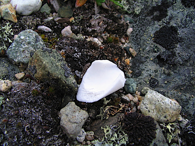
Bone fragment.
The cranberries were all doing well, as were the crowberries and bearberries. In spite of the cool, cloudy summer, it looks like it's going to be a good berry year after all.

Crowberries.

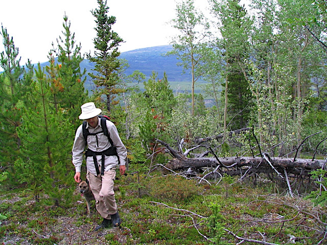
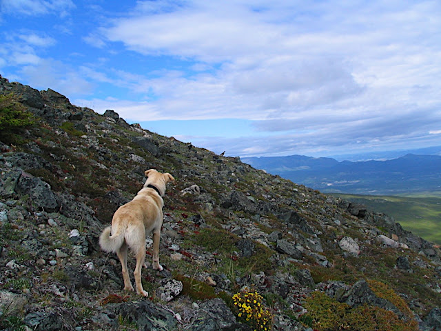
Eric and Luna above the treeline, with the ridge in the background.
The views kept betting better and better as we ascended. The area's geological history became easier to see as old glacier and glacial lake-bed features came into scale.

Geological features indicating the remails of an ancient lake bed. (If you look closely, you can see those up-and-down-and-up ridges.
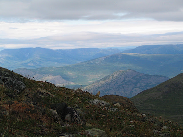
We spotted some sheep, but I knew they wouldn't be there by the time we got much closer. The wind was fairly strong and, because of the route we were taking, we would be upwind of them by the time we got near. What concerned me was that we were downwind of where we were heading. We passed some old grizzly bear scrapings and small pile of bear scat. Big piles of bear scat don't concern me; it's the small ones that do. Fortunately, we had the dogs with us, who were scouting the area fairly well.
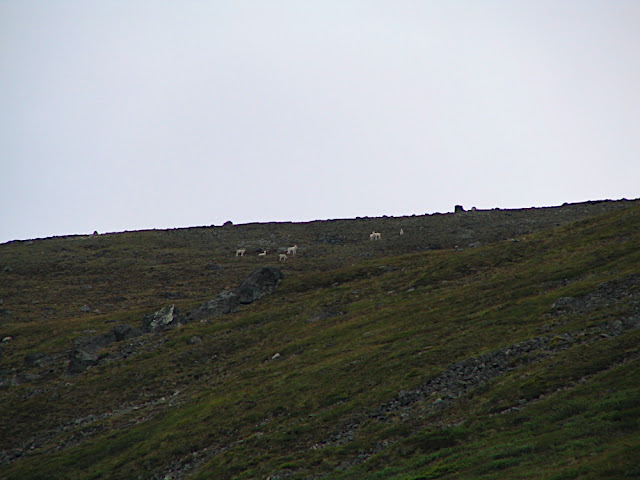
Sheep.
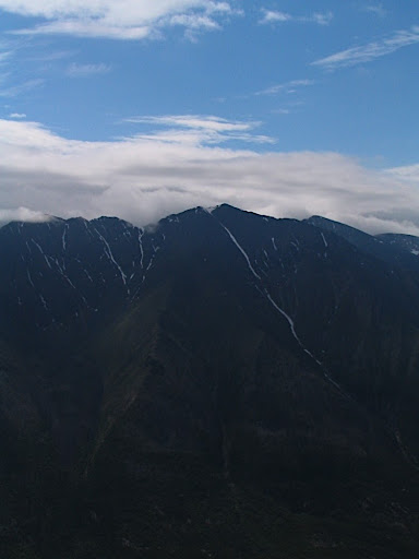
The wind blew. After several cycles of closing-in and receding again, the clouds finally lifted.
Lifting clouds.
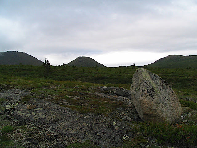
Erratics or fallen rock?
The whole area above the treeline was like an alpine oasis. I could have spend days walking from one side to the other and back again, picking berries and breathing the fresh air.
An alpine oasis.
After a fairly gentle grade, the mountain grew steep again. The scrub birch gave way to mosses and grasses and dozens of different alpine flowers.

Alpine grass and flowers.
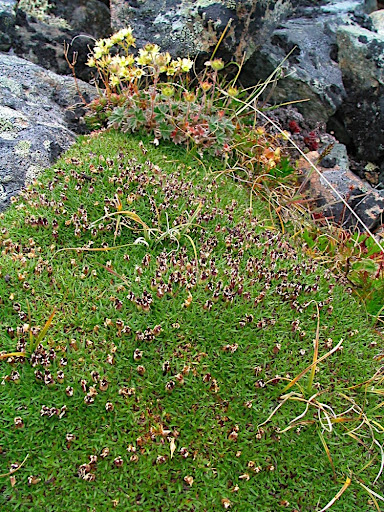
Flowers and moss.
We kept climbing and my calves started to burn. I realized how out-of-shape I've gotten this summer after having spent much of it in hospitals with Jade. Most of my exercise this summer has been on the bike.

Taking a break to relieve my calves.
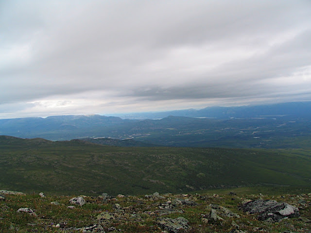
One of the things I enjoy most about climbing mountains is seeing how everything fits together. A topographical map or Google Earth can only ever give you a small part of the overall picture. I had no idea that, from the Ibex Ridge, I could see Fish Lake or Lake Laberge or a dozen other features of interest.
A small peek at Fish Lake.
A small peek at Lake Laberge.
A mysterious mountain monster? Nope. Just Nanuq's ear. He kept getting in the way while I was trying to take pictures.
The little mountain (the one sitting in the valley with the exposed rock) near Golden Canyon.
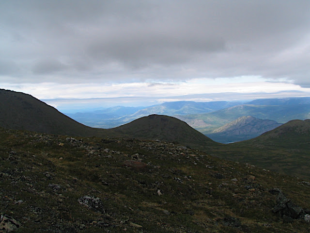
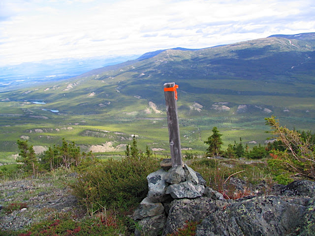
Eventually, we made it to the top of the ridge. From down in the Ibex Valley, the Ibex Ridge doesn't look like a tall mountain. From the top of the mountain, the opposite is true. Remember I said that mountains have character? The Ibex Ridge is one of those mountains that seems to want to say, "I may not look big, but that doesn't make me less of a mountain!"
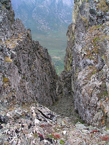
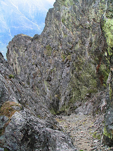
A steep crack in the ridge. Just over a kilometre to the valley floor; a loooong way to fall.
On the way up, I found a blue winter jacket. Fairly worn and with a marten scat planted on the sleeve (They do that to mark their territory. If you move it, they'll put another one there.), I decided to take it to the summit where it would be easier to find. Who knows when someone will get stranded on the mountain for a night...
If you're reading this and know the jacket's owner, please let them know it's on top of the mountain. The pockets were empty and there was no name written on it. I didn't see any bodies lying around, and there were only a couple of small tears around the hood, so I'm just going to assume that someone dropped it while they were out hiking or skiing. Otherwise, it's in pretty good shape.
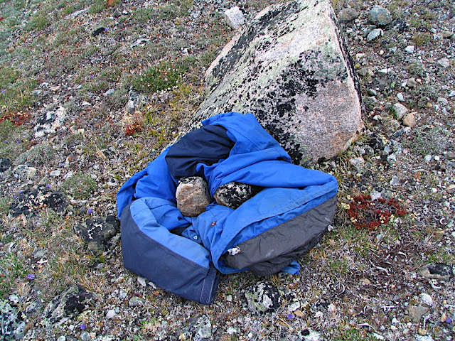
The winter jacket, weighted down with rocks at the top of the ridge - there in case someone needs it.
The "cirque" along the ridge.
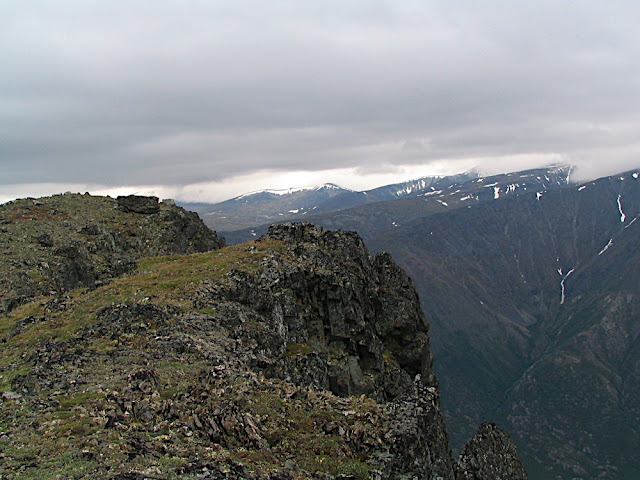
Livin' on the edge.

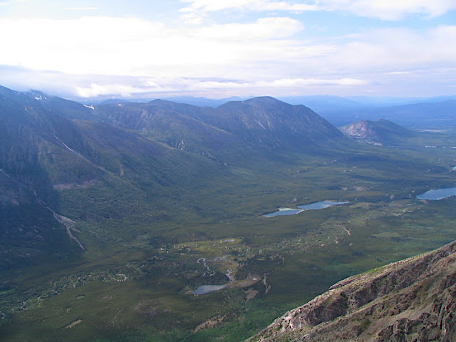
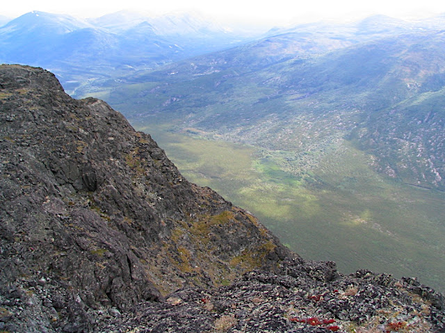
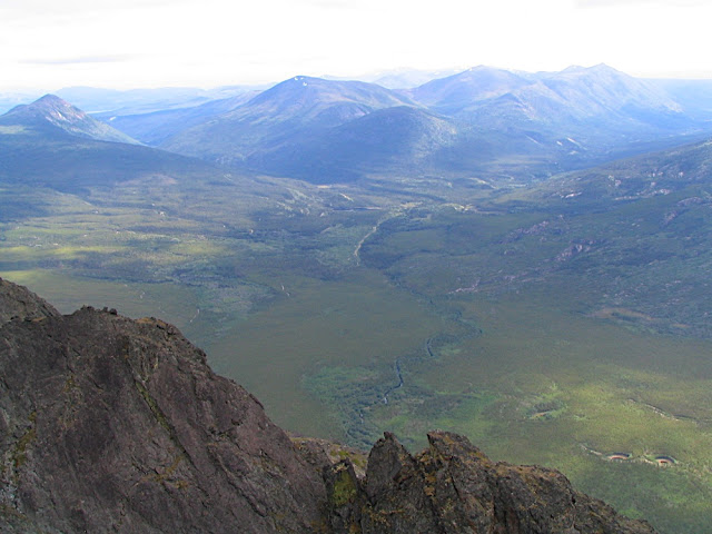
The view up the U-shaped Ibex Valley.
The Ibex Ridge faces Mount Ingram, which looks like a challenging hike. On the side of Mount Ingram is what looks like a tremendous rock glacier.
A rock glacier?

Mount Ingram, with the meandering Ibex River below.
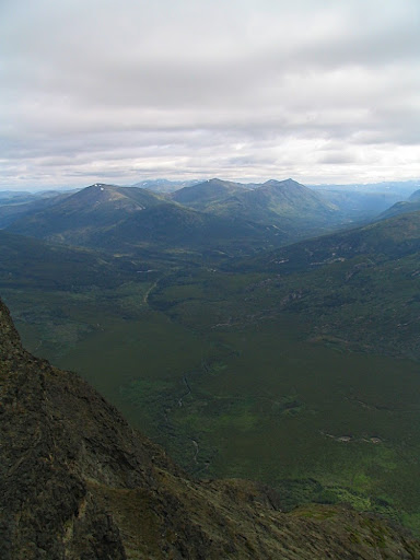
Looking towards the Takhini River and Mendenhall.
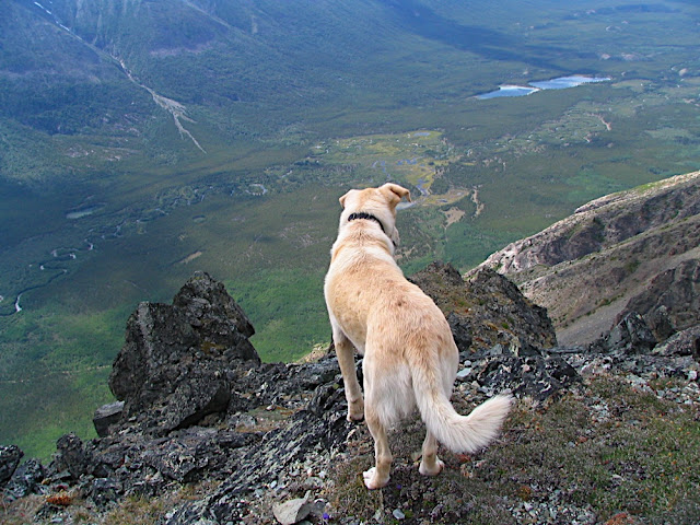
Nanuq looks down into the valley.
Dark and moody Mount Ingram.
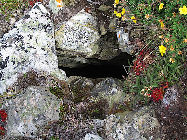
In one of the ravines that run off the steep side of the ridge, we spotted a small cave. There was a fair amount of sheep scat inside and I'm not surprised. In a pinch, the cave would make a good (albeit stinky) shelter. We couldn't tell how far back the cave went as that would have required rolling in the sheep droppings.

The cave's "smokestack".
The rocks in the ravines looked like they were coated in bright green lichen. In some cases, it was lichen. In others, the rocks themselves were green.
A rocky ravine - not a recommended route.
I found a strange circle of rocks along the ridge. It was about the size of a fire ring, but when I moved the rocks inside the ring, I saw no indication of ash or charcoal (maybe I would have if I'd gone digging, but I decided to leave that for the archaeologists). Why would someone make a ring of rocks there? It wasn't a good place for a fire: it was in an exposed location and firewood is a long way down the mountain.
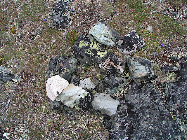
The ring of rocks.
A nifty rock in the rock ring.
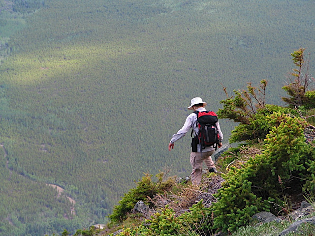
We followed the along its vertigo-inducing edge. Every ravine was different. One of them seemed to be harbouring a larger cave than the one we investigated earlier. Access to the cave would have required climbing gear so it'll have to be left for exploration on another day.

A cave on Ibex Ridge. How big is it?
The wind died and the sun got stronger. The walk along the ridge was easy and enjoyable. We kept looking for the Bouldering Festival-goers, but still hadn't seen them.
Walking along the ridge, overlooking the Ibex Valley.
Some mountains, more than others, take on anthropomorphic shapes. It's not enough that some mountains have character, some mountains are characters. When angles and light conditions are right, faces and other features appear. Of course, pictures never do them justice.

Old man on the mountain (lying down).
A face in profile.
Looking over the ridge, I saw that it wasn't just the mountain that was taking on anthropomorphic qualities. Two symmetrical kettle lakes made eyes, complete with eyebrows.

Eye lakes.
We followed the ridge downwards. It was taking us the difficult-to-travel route, but sometimes it's worth it just to avoid backtracking.

Eric and the dogs, walking along the ridge.
It's so big it almost seems surreal. It's...it's...larger than life!

A sunny Ibex Valley.

A piece of wood? Up here?
Steep..

Ice pack in August. Looks like an avalanche zone to me.

Walking down the ridge.
Farther along the ridge, I finally spotted the Bouldering Festival. Can you see them there? At the bottom of the ravine?
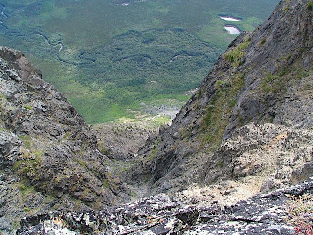
Look down. Look waaaaay down.
With the assistance of the 10x zoom on the camera was able to get a shot. It looked like there were quite a few people there. I wondered if they could see us, but that thought was fleeting. The mountain is much larger than it looks.

The Bouldering Festival as seen through a 10x zoom lens.
After taking my pictures of the Bouldering Festival, I noticed a deep crack in the top of the mountain. It may take years, centuries, or millenia for the ice to force this crack big enough that it lets go, but it made me rethink any ideas I ever had of camping under the mountain's face in the Ibex Valley.
A big, deep crack.

Approaching the treeline, looking up the Ibex River.
As we walked down, my foot started misbehaving. If I stepped on it a certain way, a shot of pain went up my leg. It felt as if my bones weren't connecting properly. Not a good place to be hobbled, I figured. I slowed my pace and eventually the pain went away.
It was hot on the east side of the mountain. There was no wind and the sun was shining down. I marvelled at how the plants were already putting on their autumn colours at the beginning of August. It wasn't just the plants, though.
What could it be that has Nanuq's undivided attention?

Ah. This must be what he's looking at. I bet Nanuq is thinking, "How could it be putting on winter plumage already?"
We started noticing old stakes, freshly wrapped in flagging tape. One was labelled in charcoal, but it was fairly indecipherable. I'm not sure if they were staking a claim or just for marking a trail, but as we followed them down, rock cairns and more stakes began to mark a very clear path.
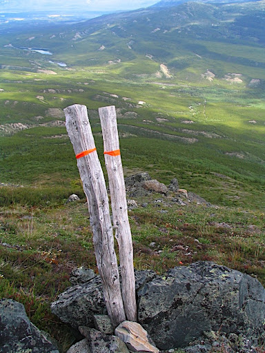
Twice as much steak for your trail-following pleasure.
Descent on the East side.
Looking back at the alpine oasis.

Alpine flowers.
Following the stakes. Scout and Cub lake are down the valley, in the distance.
Soon, the trail took us into the treeline and the old burn. Someone put a lot of time and effort into clearing and maintaining the trail. As I looked into the thick willow brush just below the treeline, I appreciated how much time and effort the trail saved us - and how much work it must have been to make the trail.

"Alligator skin" burn.
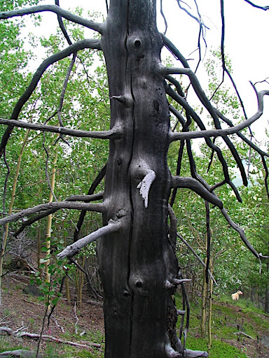
A fire-killed tree, silvery in the afternoon light.
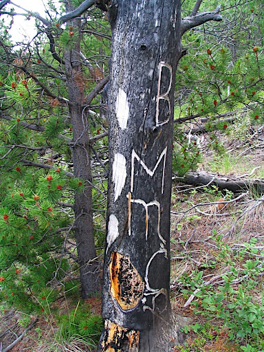
The trail-maker(s) left their mark with some chainsaw-engraved blazes on a fire-killed tree.
As we continued the long descent, I thought that the trail would make for some insane downhill biking. Insane for its technical difficulty, but mostly insane because that's what you'd have to be to lug your bike up there.
Following the trail down the mountain.
The trail connected with one of the old fire roads, which we followed to our safely-stashed bikes. We zipped down the fire road and back to the car.
From the east side, looking back from where we had parked the car, the Ibex Ridge doesn't look like much. I'm glad we took the time to know it better. It's a whole lot of mountain.
No comments:
Post a Comment